Volt::Osmaps
Volt component wrapping Leaflet.js to use OpenStreetMaps in your volt app.
Installation
Add this line to your application's Gemfile:
gem 'volt-osmaps'
And then execute:
$ bundle
Or install it yourself as:
$ gem install volt-osmaps
Usage
Map
Typical Usage to add a map with a marker:
<:osmaps height="380px" latitude="{{ latitude }}" longitude="{{ longitude }}" />
Options
- title to show a marker at the center of the map. On click, a popup will show title
- zoom is a numeric option. Default is 15
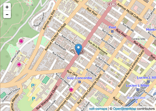
With the option title given, it will show a map as such:
You will need a geocoder if you only have a street address instead of the latitude, longitude coordinates.
Adding a marker
After you have set a <:osmaps />, you can add markers and polygons:
<:osmaps:marker latitude="{{ latitude }}" longitude="{{ longitude }}" title="{{ title }}"/>
Polygon
An array of lat,long coordinates will draw a polygon layer on the map. For example:
<:osmaps:polygon LatLongArray="[[51.509, -0.08],[51.503, -0.06],[51.51, -0.047]]" />
TODO
- make scale as option
- custom icon for markers
- paths
- circle
- app test
Contributing
- Fork it ( http://github.com/[my-github-username]/volt-osmaps/fork )
- Create your feature branch (
git checkout -b my-new-feature) - Commit your changes (
git commit -am 'Add some feature') - Push to the branch (
git push origin my-new-feature) - Create new Pull Request
Contact
Heri
- Code on Github
- I write on Medium
- Photography Instagram 500px
- Background site